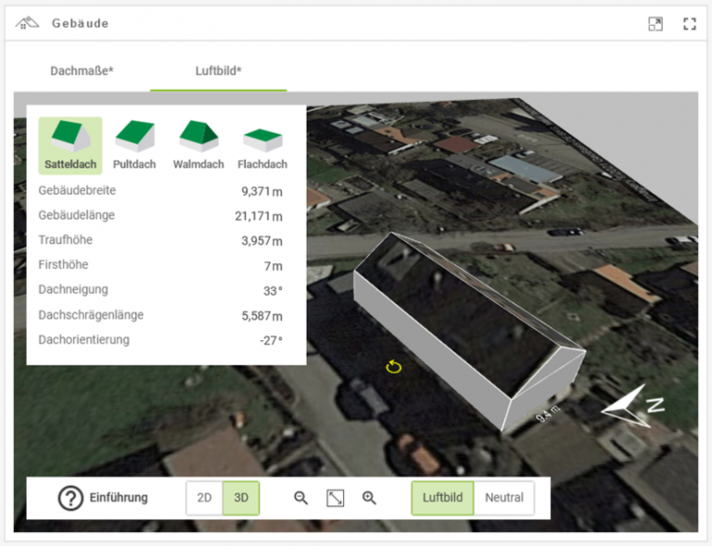
After entering the address into BayWa r.e.’s planning tool Solar-Planit, the building on which the system is planned can be drawn directly from a satellite photo from Google Maps. Location, building and roof dimensions are automatically taken over. The Google Maps function also means improvements to the user interface.
See also: BayWa r.e. expands in Ireland by partnering with Rengen Power
After entering the address data, the building data is recorded. However, this is still possible by manual input. It is possible to switch freely between the two modes. (mfo)


