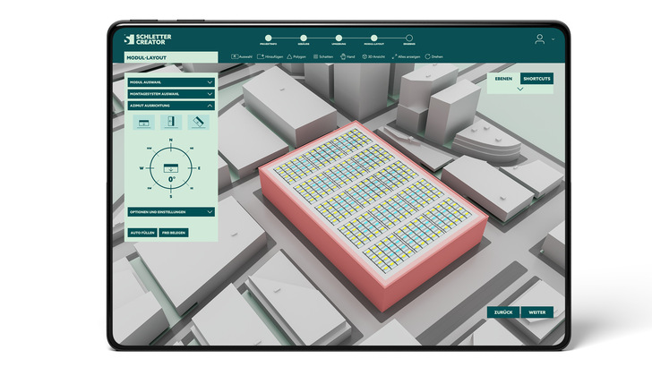
The application can be used to plan solar systems on any roof shape or covering. Roof systems are designed directly in Google Maps by marking the roof surface. After entering the roof pitch and building height, the tool calculates the exact roof area and suggests the optimal layout based on the desired orientation.
Professional users can plan and cover a standard roof in under a minute. All standard modules are integrated into the tool. By entering a postcode or town name, the system automatically applies the regional standard loads for wind and snow. A further new feature is the inclusion of current aerodynamic calculations for the so-called group effect of modules, reflecting the aerodynamic interactions that occur between them. (nhp)
Find out more on the Schletter website.


